Saturday, October 31, 2015

Glass Sands at Glass Beach

Chris, Sarah, Dylan, Mary, and Mark at Glass Beach, California.
October 8, 2015

When we finally arrived at Fort Bragg on the northern coast of California, it was 3:00 p.m. We had made the 108-mile, 3-hour drive from Bodega Bay to Fort Bragg in just 6 hours! With several stops along the way, of course. This final stop, though, was the one I was most excited about. There is one sight in Fort Bragg that I'd waited a long time to see: Glass Beach.

Our first stop was this little museum on the south end of town.

Back in 1906, the leaders of Fort Bragg established an official water dump site at the north end of town, where residents and businesses disposed of their garbage by simply shoving it over the cliff and into the ocean. This practice continued at three different sites until 1967, when the state of California stepped in and mandated cleanup operations, which lasted for decades.

The smaller bits of glass in this display are typical of what's now found on Glass Beach.

Anything biodegradable was long gone, of course, but items such as vehicles and appliances had to be hauled away, often sold for scrap or used in artwork. The glass items, however, from bottles to jars to glasses to dishware, had long been pummeled to pieces and polished by the pounding of the surf, and it had begun to be washed up on shore.

The man who runs the museum has been scavenging the glass for decades.
He had many larger pieces, some of which were fashioned into jewelry or sculpture.

Much of the glass cast up on the beach was of jewelry quality and in high demand. Over the years, those pieces have dwindled as beach-goers have helped themselves to the best shards. Even today, there are some who fill up entire bags with the glass bits to take home with them. If they are caught, they are ticketed and must pay a fine, but still visitors persist in doing it. In fact, the loss of the glass has become such a concern that visitors are now encouraged to purchase little bags of broken glass to throw back into the ocean so that it will return again to the beach someday.

Mark, Dylan, Sarah, and Chris hike along the cliff above Glass Beach (at right).
The fog met us there.

We only spent about 20 minutes in the museum before heading to Glass Beach. We hiked a mile or so past the entrance to the beach, hoping to find another way down, but there was none. All we found were signs warning us to stay back from the edge and reminding us that we could be trapped by high tide if we ventured down to the beach below.

View from the cliff above the beach. These waters are very rocky.

Dylan, Mark, and Chris take the steps down to the beach. 
It doesn't look so steep from this angle, but...

...here you can see how steep it truly was. Eventually I did make it to the bottom,
but I hesitated to put my knee through that torment. It was slow going for me.


Glass Beach isn't very large, but I found its jagged terrain to be visually striking. The fog shrouding the ocean and wafting among the rocks just added to its mysterious appeal. Even in Southern California, my favorite beaches were always the rocky ones, with tide pools and sea caves and mini-waterfalls bursting with each new wave.

Chris, Dylan, and Mark sift through the glass-studded sand.

Sarah watches the waves.

Glass Beach, California.

Mark and Dylan continue their search for glass treasure.

I loved this craggy area.

To me, the whisper of waves is the most relaxing sound in the world.

Dylan took this amazingly crisp shot of the crystalline waves rushing to shore.

So, you may ask, what is the big deal? It looks like an ordinary beach with course gravel and large pebbles instead of fine sand. But take a closer look at what's beneath your feet...

This is my closeup of the sand. There is far more glass than pebbles.
The most common bits of glass are white, clear, green, and amber.

This is Dylan's closeup of the sand. He says it puts mine to shame.
(Don't forget, you can click on any of these photos to enlarge them.)

There are places in the rocks like this where the glass has gathered in the seams.
I love the whole pirate's-lair, gems-spilling-out-of-the-treasure-chest look!

My best specimens.

Given the restrictions on collecting glass from the beach, we settled for searching out just a few of the best pieces we could find during our short 2 hours on Glass Beach. We were really hoping to find some of the rarer colors, deep red and bright blue, but I had to settle for two whites, a green, and an amber. And one that I'm not sure what it used to be!

Dylan's four finds. I suspect one or two were interestingly polished rocks
rather than glass, but we couldn't be sure.

Sarah takes her search right into the water.

Sarah decided not to limit herself to what had already been picked through on the beach. Instead, she kicked off her shoes and waded into the surf to see what the tide might carry in. The tide was indeed rising during our visit, and her diligence paid off. While none of us found a coveted blood-red shard, Sarah did find two beautiful blues and an incredibly vivid green unlike any the rest of us had found.

Sarah's tiny treasures.


The sun, shrouded in the haze, is getting lower as the tide comes in.

As we prepare to leave, Dylan takes a final picture of the little cove...

...and here's the picture he captured!

A last family photo on Glass Beach.

Dinner at Denny's in Fort Bragg.

Just 2 blocks up the road from Glass Beach is a Denny's, and that's where we had dinner before starting the drive home. I had actually selected a restaurant across the street, called Jenny's Giant Burgers, but when we drove by we saw that the seating was mostly outside. The kids decided it was a little too cool by now to sit in the damp breeze (although the fog itself seemed to be contained mostly below the cliffs), so they voted to stay warm inside Denny's.

Sarah, Dylan, Chris, and Mark waiting for dinner in Denny's.

Mark went all out on steak and eggs for dinner.

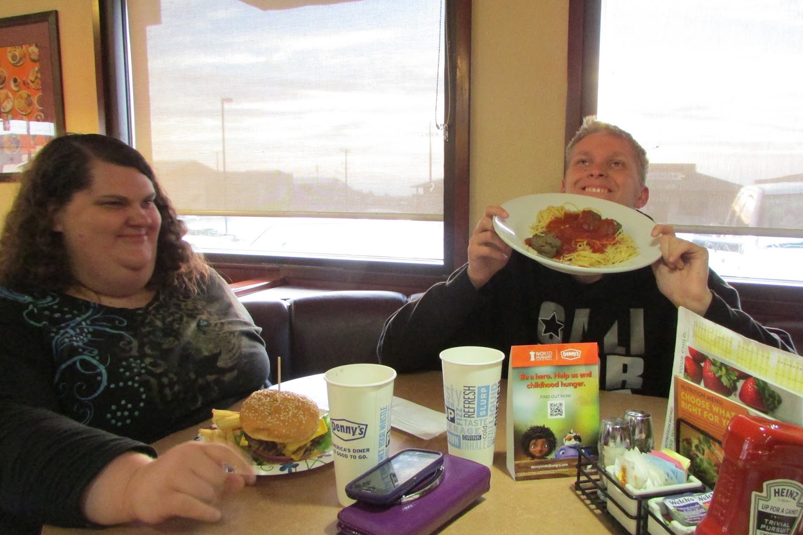
Dylan does love his spaghetti and meatballs.

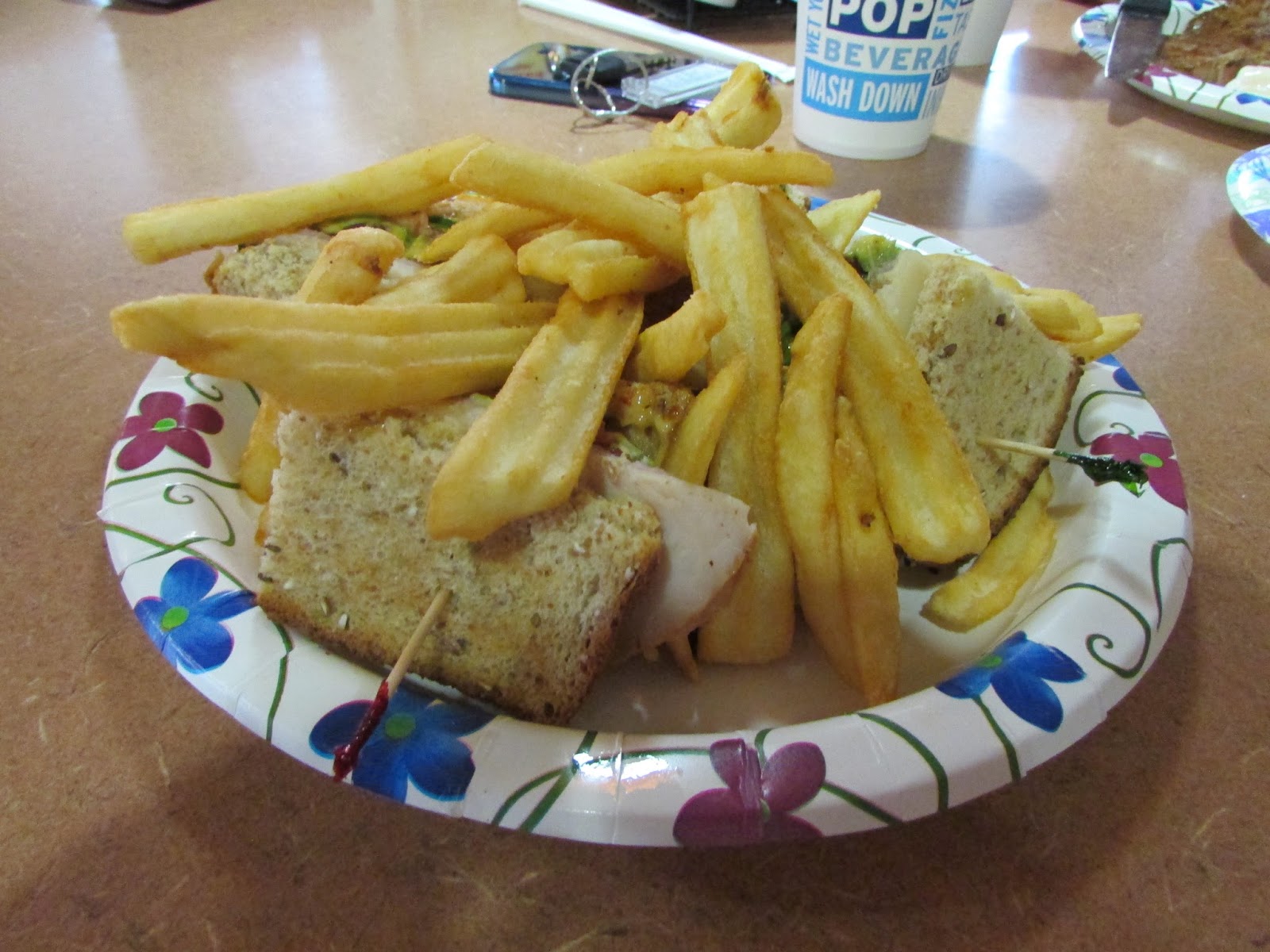
Another club sandwich for me. Is it any wonder that
I gained almost 8 lbs in 12 days of vacation?

After dinner, we still had a long drive ahead of us (complicated by some serious roadwork along the way) as we returned the Traverse to the rental company in Santa Rosa and then drove back up to the resort in Windsor. In all, it took about 3 hours to get back. It was just growing dark when we left Fort Bragg to drive a narrow, winding highway east to Willits, which was actually the first town in which my son Jacob served on his mission in early 2011. We wished he'd been there with us. Then from Willits we turned south on Highway 101 and continued all the way to our welcoming beds after another very fun, very full day. 

The evening sky as viewed from Denny's at 6:25.

The evening sky 40 minutes later, at 7:05, looking out the window from our booth.

Friday, October 30, 2015

Cruising California's Coast

October 8, 2015: Mark, Mary, Sarah, and Chris pose for a picture 
on the side of the road somewhere along the Northern California coast.

On Wednesday, October 7, we spent the whole day at the resort while we recovered from the rigors of our day in San Francisco. We did some laundry, watched some television, napped, grilled, ate, and swam. I even found some time to blog. Then we turned in early because we had big plans for Thursday.

Our rental car, a 2015 Chevy Traverse, in Bodega Bay.

We left the resort just after 7:00 Thursday morning and headed south to Santa Rosa, about 15 minutes away. There, we stopped to pick up our rental car for our long drive up the coast. I had requested and been promised a minivan, but when we arrived they handed us the keys to an SUV instead. I wasn't too happy, especially given the cost, but I was assured that the Chevy Traverse had a third row seat, which was what I wanted so the people in back wouldn't be so crowded. While it wasn't nearly as roomy as a van would have been, it worked out okay. And I admit I enjoyed driving it. The Traverse handled well.

A view of Bodega Bay from Coast Highway 1.

We got on our way soon after, heading through miles of vineyard-covered wine country toward the town of Sebastopol, and then along Bodega Highway to the small town of Bodega Bay. We arrived around 8:30 and stopped to use the restroom at a '76 station. We paused to look out at the bay situated between the town and Bodega Head, a finger of land jutting into the Pacific, creating and protecting the bay. We were so near the ocean, and yet we couldn't quite see it. 

The Pacific Ocean at last! But notice the low gray line settled on the horizon.

After we drove a little further north, beyond Bodega Bay's town limits, there it was: the beautiful, blue Pacific. I had never been to any beaches north of the San Francisco/Oakland area before now (except in Oregon in 2010), so this was exciting to me. However, until we reached our final destination in Fort Bragg, we were never able to get down to the water's edge to walk in the sand or wade in the surf.

Unlike Southern California, where the beaches all have names and most are well-developed with easy access, the coast of Northern California is still largely rugged and untamed. Most of the shoreline is extremely rocky, and the beaches are small and hard to reach because they lie below tall cliffs and bluffs. Most of the access points we passed required payment for even a brief stop, which I didn't feel was worth just a few minutes to take pictures. So we pressed on, stopping occasionally to take pictures from afar.

My first selfie overlooking the Northern California coast!
It may not look that far down to the beach from the bluff where we stood, 
but that stick on the sand behind my head was actually a log large enough to sit on.

At our first stop, in the above two pictures (somewhere between Salmon Creek and Gull Rocks, I think), I noticed a long, low, gray cloud rolling along the horizon in the distance, hovering above the water. I pointed it out to my family. The sky above was sunny and vividly blue, but I said, "See that fog bank? It's probably heading our way. I hope we get where we're going before we get fogged in."

The first of many stops for roadwork along the way.
This is where the highway crosses Timber Gulch.

As we continued on our way, we soon learned that even the Coast Highway (or, later, it becomes Shoreline Highway) requires maintenance. We were halted by road crews several times before we reached Fort Bragg.

By our second photo-stop, the fog was making landfall just ahead of us...

...and closing in behind us, just half an hour after I first saw the fog bank.

Our third photo-stop, 10 minutes later, put us a little ahead of the fog,
after we rounded that headland which cut it off.
This is looking south, from the highway just south of Fort Ross.

Looking north. Fort Ross is around that corner and a little way beyond.
The fog bank is still visible, heading toward shore.

While we were at this third stop, Mark went off to answer nature's call.

Meanwhile, Dylan decided to get this photo of his mother.

A small market in the town of Gualala.

By the time we reached the town of Gualala around 10:45, we were all in desperate need of a restroom. We stopped at another '76 station, only to find that they had no public bathroom. Imagine that! They directed us across the street to the Surf Market. Thankfully, the market was equipped to help us out, so we returned the favor by loading up on snack items from their store.

Dylan entertains Sarah and Chris while they check out at the Surf Market.

Sarah, Mark, Dylan, and Chris load our goodies into the rental car.

Pirates Cove Restaurant in Point Arena, California.

From Gualala, we drove directly to our next planned stop in the town of Point Arena. By now it was 11:30 and we were ready for some lunch. I had located a restaurant called Pirates Cove that had good reviews for their Mexican food. So, of course, Dylan and Chris ordered burgers and fries while Mark got fish and chips. Sarah and I enjoyed our enchiladas, though.

Chris and Sarah in Pirates Cove. That's my yummy plate in the foreground.

Mark with his fish and chips.

The Point Arena Lighthouse, with the museum behind it.

About half an hour later, after lunch, we drove directly to the Point Arena Lighthouse, just ten minutes away. By the time we got there, around 12:30, the fog was seriously rolling in. 

Dylan's shot of the Point Arena Lighthouse.

None of us had ever been to a lighthouse before, so I thought this would be a fun experience, and it was. The Point Arena Lighthouse  was rebuilt in 1908, after the original was destroyed in the April 1906 quake. The lighthouse is 115 feet tall and is located on the one point of land (surrounded by water on three sides) in the continental United States that is closest to Hawaii, 2,285 miles away. I love trivia!

The entrance to the lighthouse.

I didn't dare to attempt to climb the tower with my knee swollen and painful as it had been for over a week now, so Sarah and I waited below while the three guys climbed the 144 steps to the top. Dylan said it freaked him out a bit at first, and he found himself hugging the wall once he'd reached the parapet at the top. Then he got busy with his camera and forgot to be nervous.

Dylan looks up at the spiraling steps above their heads.

I took this picture of the three men at the top of the lighthouse...

...while Dylan took this picture of me down below, taking their picture!

His camera has a good zoom lens!

I'm sure the view would have been magnificent without the fog!
The coastline here is quite rocky and rugged, so a lighthouse makes sense.
Dylan captured this misty shot from the top of the lighthouse.

Dylan, Mark, and Chris return from exploring the lighthouse

We spent a little time in the museum (where I got another awesome tee-shirt).
I believe this was one of the Fresnel lenses that originally illuminated this lighthouse.

Rocky waters below the lighthouse.

After spending about 45 minutes at the lighthouse, we drove back into the town of Point Arena and then resumed our journey northward on Shoreline Highway 1 toward Fort Bragg. We made just one more photo-stop along the way.

Multiple paths wound through this dense ground cover.

Somewhere between Point Arena and the town of Elk, around 1:30, we came upon a sign that seemed to direct us on an access road to a beach. We followed it to its end, where further signs warned us to stay clear of the cliff edges, but again seemed to indicate that one of the paths would take us down to the beach. We wandered around for a while, but all our paths led to the bluff's edge. We didn't want to be here all day, and my knee was hurting, so we finally gave up a little after 2:00. Nonetheless, the windswept area was strikingly, even savagely, beautiful.

Another selfie. My hair was pretty well whipped by this time!
We did find the beach, several yards below us.

And then we were off again, on the final leg of our adventure to explore the northern coast and discover the beach I'd most been anxious to explore: Glass Beach! Stay tuned...

I love these last two pictures most of all. Here, 
Dylan trudges north across the top of the bluff alone.

Then Dylan turns back and captures this moment:
Sarah, Mark, and Mary looking out on the misty Pacific.